- Landforms
What is a Plateau Landform?
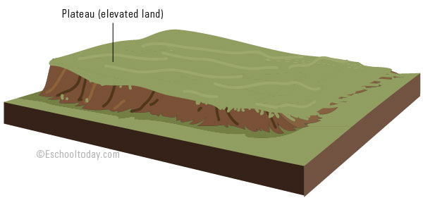
A plateau is an elevated land with a flat top and steep slope on at least one side. The elevation is usually between 90 to 900m.

Plateaux (more than one plateau) occur in almost every part of the world and are one of the most common landforms. One major difference between a plateau and a mountain is that a plateau is flat at the top. Table Mountain in Cape Town South Africa and the Tibetan Plateau in Central Asia are two great examples of plateaux.
A plateau can be formed by tectonic activity. Converging forces in the earth’s crust can cause plates to be pushed slowly upwards. Extreme heat buildup can also force plate movement upwards. A plateau formed in this way is called a Tectonic Plateau.
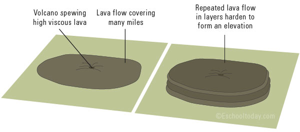
A Volcanic plateau (also known as a flood basalt) is another type of plateaux. The regular and repeated flow of highly viscous lava from volcanoes can slowly build up and spread over many miles, and solidify to form plateaux. Sometimes this can involve many small volcanoes.

The illustration above shows how repeated the flow of laver layers to form an elevation.
Weathering and erosion can influence the shape of plateaux. An erosive activity can result in massive cuts and gullies through a plateau. They can wear down softer rock areas of the landform, leaving only the hard and rocky bits standing tall. This is called a dissected plateau. The Chotta Nagpur Plateau of India is an example.
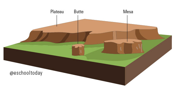
With time more erosion will rip the plateau into smaller landforms. It is important to know about these two terms, Mesa and Butte, as they are often confusing for many people.
Consider the illustration below:

When plateaux are weathered and eroded, some areas of hard rock are left uneroded. The hard rock often protects the rock material beneath it. When this happens, a mesa is formed. A mesa may be wider than taller.
Similarly, a mesa will be weathered and eroded, and with time, a small piece of the mesa is left. This is a butte. At this time, the butte is taller than wider.
