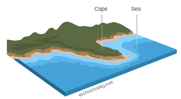
A cape is a raised piece of land (also known as a promontory) that extends deep into a water body, usually the sea. It is usually a coastal feature. From above, it is a distinct change from the regular trend of the coastline. There are so many capes of many sizes lined up on the coasts of all the continents.
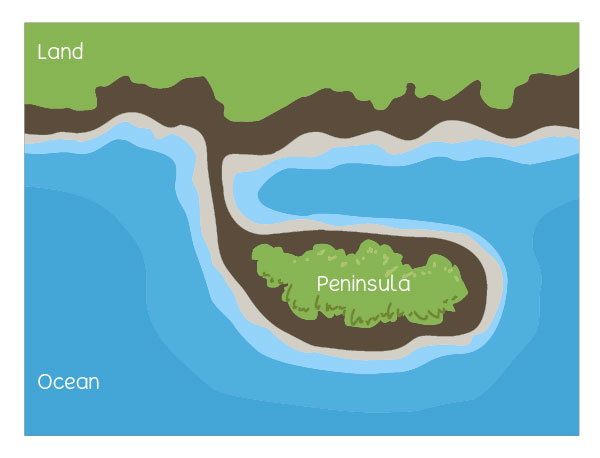
A cape and a peninsula can be confusing. Here is the difference:
- A cape is connected to the mainland by a larger mass of land than a peninsula, which is connected by a thin landmass. In other words, a peninsula is almost an island.
- A cape is bordered by water on two sides, but a peninsula is bordered by water on three sides.
How do capes form?
Capes are formed in three ways: by erosion, ocean currents, and glacier. Depending on the nature of the rock material of the cape, one can tell its formation.
Rocky capes are carved out of erosion by ocean currents, where the softer rock material is washed away, leaving the rocky bit.
Sandy capes are a sign of two ocean currents clashing and depositing fine material (gravel and sediments) where they meet. With time, the sediments pile up and form a pointed landform projecting into the sea.
Glaciers can also carve their way into a land area and deposit moraine (sand, sediment, and gravel) after they melt away.
Great examples of capes include:
- Cape of Good Hope, South Africa, which is part of the Sandstone Table Mountain and believed to have been formed by erosion.
- Cape Cod and Cape Ann, Massachusetts in the USA. Cape Cod is believed to have been formed by glaciers.
- Cape Morris Jesup, Greenland. This is known to be the northernmost point of the mainland.